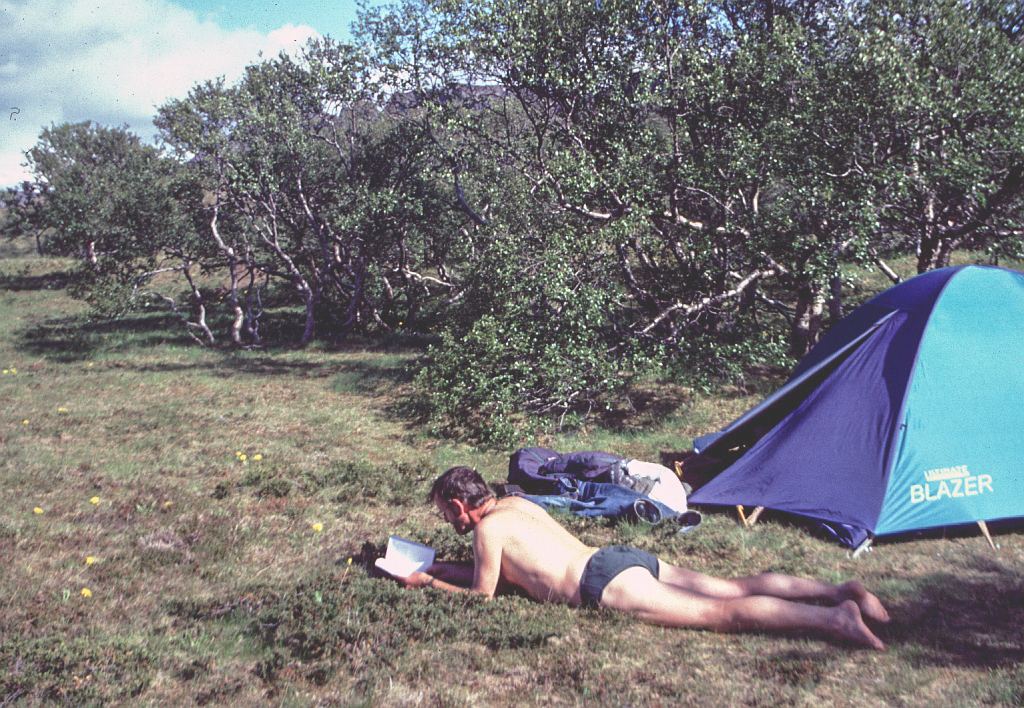
20-6-2000 (day 4)
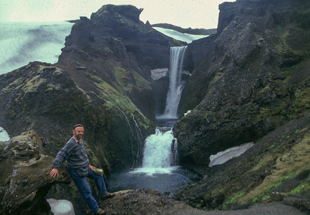
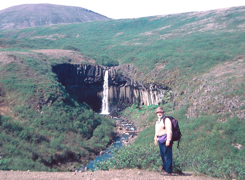 The sun is out, it's not too windy and we are ready to tackle a big hike, up to the top of Kristinatindar (1126m). It is situated between the two glaciers, Morsarjokull and Skaftafelljokull. Initially it went easy, knocking away the altitude metres. At the waterfall called Svartifoss we had a short photographic stop. This is the fall that comes down from the top of some beautiful basalt columns and is well known because of this. And up we went, I was running out of steam. My initial demands for a coffee stop were refused. At about 700 metres we finally had one and made it lunch at the same time. After that I felt better and charged up the mountain. Hiking became more difficult higher up with steep slopes, loose rocks, snowfields and exposure to the wind. But we made it and had a cup of coffee on the top.
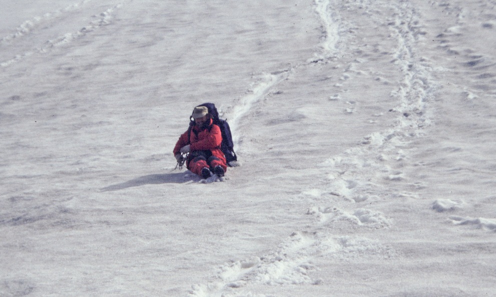
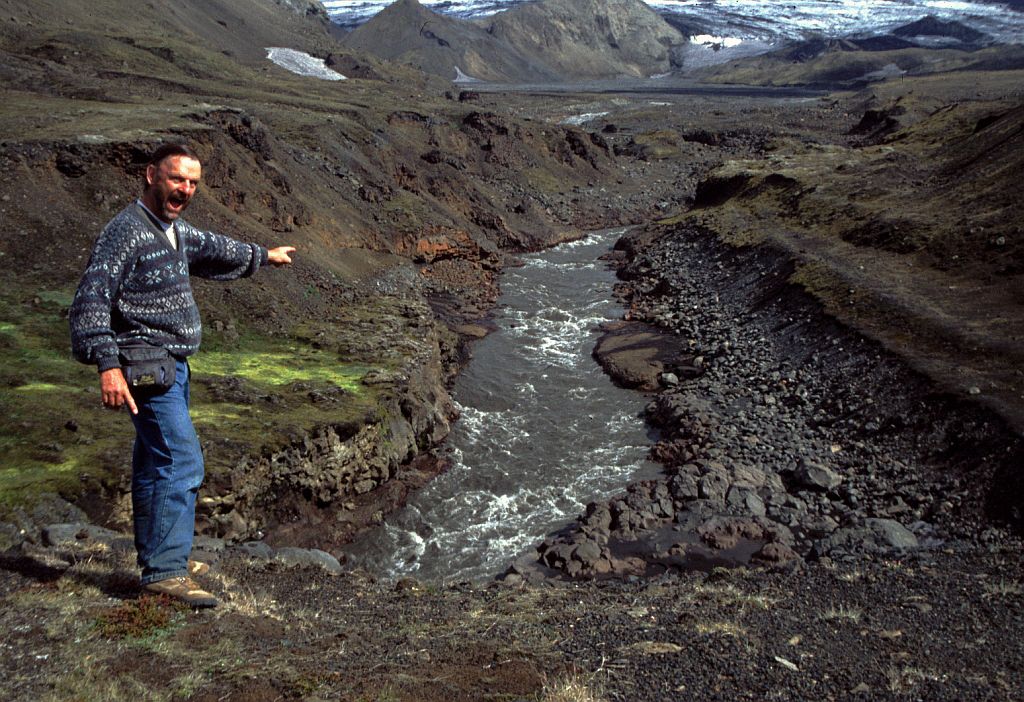
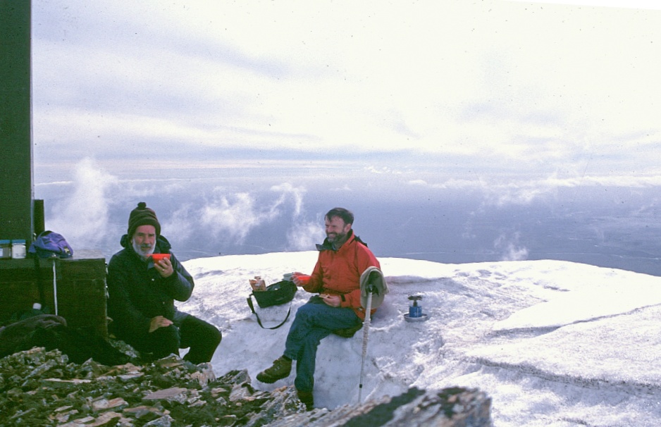 The view from up there is tremendous, looking over the ice shield of Vatnajokull and seeing the beginning of the glaciers as they fall off the ice sheet making their way down into the valleys. Only about 5 metres from the top we found this depression in the snow, which served as a cover against the biting, wind to have our coffee. Jim made himself a seat on the snow bank, I rather stuck to the rock, its more solid and looking from below we knew that this snow was hanging snow.
The route down was easy enough, once we had cleared the steep slope and loose rubble near the top. We left the top at about l6h00 and got to the bottom by l9h00. That part of the hike was without any major stop. And now we are sitting in the warm cafe having coffee at I50 Krona each writing this story. We also thought that we should have a shower, but this was l00 Krona for a 5-minute shower. So, in order to save some money we had one shower between the two of us, i.e. save money, shower with a friend.
 20 June
7.30am was fine, dry and cold with light cloud as I read Blackmore about memes and broke my fast on blueberry porridge, coffee, Provita and cheese at the grey table and a nesting heidloa flolover) limped away. Up the hill we went again, to the Giant s-Causeway fractured basalt overhang of Swartifoss then an endless patient trudge (and lunch) up the ridges, screes and snows of 1126m Kristinartindar: for 4pm cappuccino and peanut-buttered biscuits on ice. Then another weary trudge back down, overlooking yesterday's glacier; for a stiff (after a jogging tumble) outdoor supper; coffee in the cosy shop, and a shared shower and laundry.
21-6-2000 (day 5)
Since we thought that we had done everything in this area we felt it appropriate to move off and get to Skogar. That meant climbing on to the bus by 11h30 and before we did this we had a short walk along the bottom of the mountain to see the big river plane and to check on the dam work that has been done there to protect Skaftafell against floods. Those floods are caused by melting glaciers or what is worse, and that actually happened in l993, is a volcanic eruption under the ice.
In the bus it was all explained to us by a tape, how the volcano Katla erupted under the ice causing huge masses of water to come down, bringing water and rocks and wiping out parts of the road. It is processes like this that cause the extensive flood plane to be formed. It is this flood plane that we saw from the air coming back from Greenland two years ago. This was when I commended to Jim about the wildness of this place.
Further on we crossed a huge lava field. That was also explained to us. It's the lava that came from the Laki eruption in 1783/84, it is said to be the largest lava flow in human historical time in the world. A lava stream 25 km wide made its way from the Laki crack down to the sea, a distance of about 50km. It caused a catastrophe not only in Iceland but in Europe as well where low summer temperatures due to the clouds of smoke and ash absorbing solar radiation had a detrimental affect on agricultural production.
The bus stopped for lunch in Kirkjubæjarklaustur. Since we weren't interested in the 'cheap' lunch being offered in the hotel we did a walk through the little town. Had a look inside the church and identified the position of the former cloister that existed here till 1550. At the local shop we bought some nourishment, i.e. cheese and caviar, and here we also had the cheapest cup of coffee on the trip, it cost us nothing. It was part of the service, not only was it cheap it was also good coffee.
 Walking through town gave us a chance to check up on what the Icelanders have got growing in their gardens. One thing we certainly could not see were fruit trees and also no vegetable patches, I presume the growing season is too short for any of those.
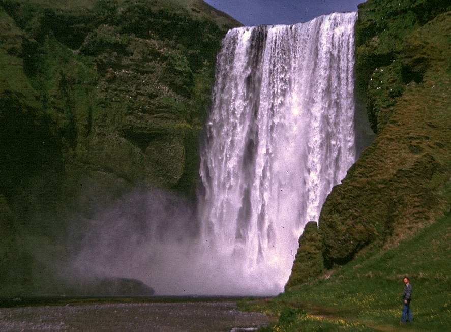
Getting to Skogar (pronounced skoar) we first had to have a photographic session at this fantastic waterfall. It is 60 metre high and about 30 metre wide falling down like a curtain over this width. And this I pronounce the most beautiful waterfall of Iceland.
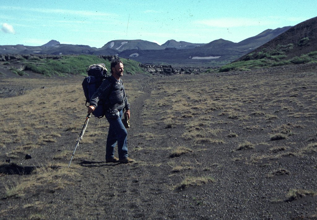
And for the first time we actually had to pick up our rucksack carry it up and up the mountain. Fortunately, except for the beginning, the slope is fairly gentle and being distracted by the scenery of the rushing river and numerous waterfalls one doesn't notice how one climbs. Waterfalls we had plenty, after the third one I gave up taking pictures. They also helped to give us some idea of how we were climbing.
At a suitable spot we put up tent, it was l9h00. Jim decided to walk back to our last coffee stop to fetch his pot grip (you will hear more about this %"&*$ pot grip further on). I estimated that our camp was at an altitude of about 500 metre.
22-6-2000 (day 6)
We are sitting at the hut, close to the highest point of the crossing, having lunch. The higher we got the more snow we had to cross, it ’s very tiring. The last kilometre, at least, was all snow. That is why we are sitting here drinking cup after cup. The weather is very pleasant. I actually took my boots and socks off to give my feet a bit of sunshine.
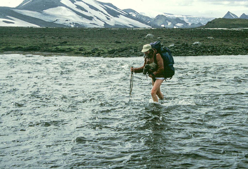
We had a peaceful night thanks to the small flat piece of grass that we had found to pitch our tent. Soon after setting off we arrived at the bridge that took us over the Skogar River Snow still covered a lot of the river's run, which enticed Jim to try and cross the river on the snow. Me protesting and telling him that he is crazy didn't help. I had to use my length of rope to add to his so that he would at least have a rope in his hand as he crashes through the snow bridge into the ice cold water of the river. It didn't happen. He actually did us a service because we found later on that there were rivers
that we had to cross this way and this little episode gave us the confidence that it can be done.
 The snow didn't end with the hut, there were a couple of kilometres after that, fortunately mostly downhill. The highest point of the hike is at about 1100 m. Our boots and socks were totally soaked after we had finished with the snow. Sliding down hill made life a bit easier.
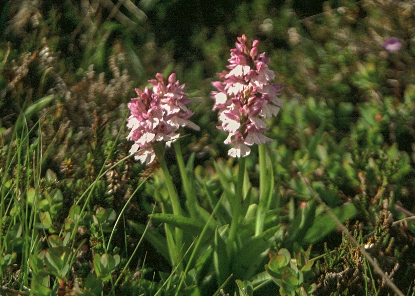 As we went down and down the vegetation improved, to be finally greeted by lovely fields of flowers at the low levels. It was the usual buttercups (Ranuculus acris), geraniums (Geranium sylvaticum), thrift (Arrneria maritima), lupins (Lupinus nootkatensis) and some ground orchids (Dactylorhiza maculata). We were now in the Þorsmörk valley, the Rivera of Iceland. And now to the selection of the camp-site. The first one Jim didn't want to use, 'lets rather go over to the one that forms the starting point for the hike to Landmannalaugar'.
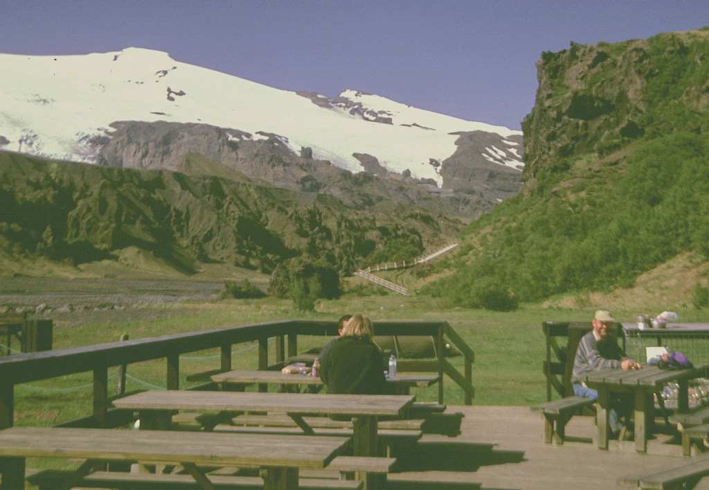
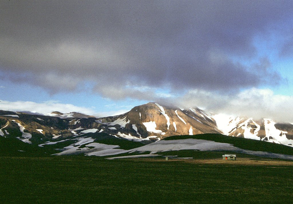
Slogging on and following the road we got to the camp-site, only problem there was a river between the site and us. The water was flowing strong and it looked reasonably deep. Jim tried to wade through it, but the water was so #$%"& cold that he had to give up after only a short distance through. But then we spotted a bridge; it was a bit further down stream, about 500m off. It was still a long walk because we were unable to go straight for it, we basically had to get back to the main road and then make our way down, because there was another raging torrent to be crossed which also had a bridge over it. Jim at this stage was so pissed off that he didn't want to pay any camping fee. 'Let's just go on', he said. I went to pay and said 'we camp here', that settled that one. I mainly decided to stay there because I had visions of a hot shower and a good toilet. The second one was provided, but the cost of a hot shower was 200 Krona, so we skipped it. But there wasn't even hot water from the taps in the ablution, now we were both pissed off. But it is such a beautiful surrounding, both snow caps clearly visible, with glaciers coming off, lovely flowers and sunshine.
22 June
 Grey skies and a hearty cocoa, porridge, rye bread, butter and cheese after a cosy enough night with the rumble of distant falls. Sign at a 9.30am footbridge: Nick Mason from Skotland - 24 years old - Died by drowning in Skogaa - 12" of august 1984. Not I. Practised careful (roped) ice-bridge crossing, for later Wearily trudged up Skogaheiði and across crunchy sinky snowfields to sit on the 1 pm sunny porch of Baldrinsskali A-frame sleeping-bag hut (gas and tables below, mats up ladder in loft).
Then over the 1116m Fimmvörðuhals inter-icecap saddle by another 3.5km of snowfifield trudging for cocoa (ah cocoa!) behind a rock in sun and chilly wind, then a long cinder-track and green&pleasant ridge descent to Godaland. Then I had to go and suggest bypassing the nearby camp-site, forcing us into a weary effort to cross the Krosso river; too cold and deep for me to wade, by distant bridges distant with wet approaches. But by 9.30pm we were cooking at a Þorsmürk camp-site table.
23-6-2000 (day 7)
We wanted this to be a semi rest day. Jim still managed to chase - pull me up some mountain of 458m. Fantastic view from the top, we could see down into both valleys, we could look back and check out the pass that we had come over and we could look forward towards Landmannalaugar. The route back from the mountain led us through some typical Icelandic forest of birch trees. It was here that we decided not to spend another I000 Krona for a camp-site but rather to be on our way and to sleep somewhere in the forest.
I had established that this place, and in fact no place in the valley, had a telephone. This put me into a bit of a spot; Eleni was waiting for a call from me. I also found out that there would be no telephone in Landmannalaugar. In desperation I picked on an American birdwatcher, gave him 100 Krona and the telephone number and asked him to phone when he gets back to Reykjavik. As I found out when I got home, he did phone, nice chap.
 Late in the afternoon we picked up our rucksacks and marched off for about 2 kilometres; near the end of the forest found a nice spot between some trees and that is where we put up our tent.
The forthcoming river crossing had us worried; it was going to be our first. Will we be able to stand the ice cold water long enough to make the crossing? I took a short walk down the stream and then upstream to see whether there would be an easy way to cross, like hopping from stone to stone. No such luck, it was flowing rather strong and wide everywhere.
23June
Stifflegs after that 18km (6km of snow) made for late porridge, tea and sunny reading. God,'s land
(Þorsmörk) has birds, birches and babbling streams, so lets sit around. I bought a fourth disposable camera for the usual twice-the-price. Prices like Kr5O0 (R50) each to camp, and R20 for a 5-minute hot shower (no hot water in loo taps ‘for washing hands and faces only") seem hostile, making me anti-Icelandic in the glorious surroundings - birch copses on buttercup grass on lava hills to the fore, snowy tops behind. But probably half the triple-level pricing is because of our by-ANC-under-valued Rand. The Inverkeithing girl camper had a jolly laugh. The warden ('oes' for yes) is a Reykjavik carpenter in winters 6 months, then spends 6 months in this prime private hostel/camp site, meeting the river-fording tourist buses and hikers.
Up 458m Valahnukur we walked, past helicopter-dropped 1t sugar-bags of gravel awaiting summer UK school kids who wheel and rake out footpaths, to view 16I8m Eyjafallasjokull (south), 1450m Myrdalsjokull (east), and 1462m Tindfallajokull (north across Markarsfljot river, up whose eastern side we would be heading). A plover limped away from its pretty four-egg nest. We descended by Songhellir cave and Ussa outcrop to Assa, then returned up east-west Husadalur valley past a (hot water?) drilling rig and Snorrariki hole in name-carved cliff and down pretty Langidalur to camp, then I ran back up to fetch my bumbag. After a snack. we moved off to the north side of Þorsmörk to camp free on mossy grass by sunny birches and do some evening reading, tanning and exploring in this paradise/Valhalla place fit for elves and hobbits.
24-6-2000 (day 8)
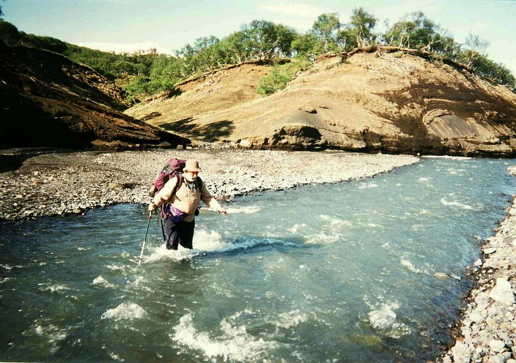 So, this was my plan then, I kept on my long pants and socks and slipped into sandals. The thinking was that this would give me a bit of insulation against the cold water. Jim was less bothered and just took off his pants and walked in underpants and sandals. It went very easy, was only knee deep and before the pain started we were through. I kept on walking before changing into dry socks and to put the boots back on to warm up my leg muscles.
And now we walked and walked, first up the hill then down the hill, over a bridge spanning a deep and wild gorge and on we walked. The landscape changed from grassland to desert. There were a few more rivers to cross, they were minor and didn't worry us much. Crossing them by wading through or even by walking over a snow bridge; that that was possible Jim had demonstrated so aptly two days ago.
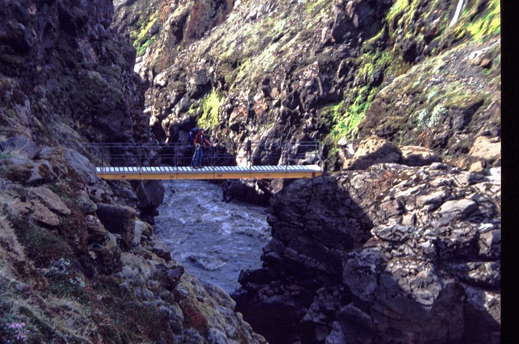
The last river crossing before the hut, the Fremri Emstrua, had us worried, the map showed that we had to ford it. Walking along it for some distance made us wonder how the hell are we going to cross that? The melt water was murky and running very strong. And then as we turned a comer there was a bridge, it looked very new, so obviously before that was built one had to ford the river.
 From here it was only a strenuous scramble up some hill of loose sand and rocks plus some 2 kilometres of easy walking and we got to the Emstrur hut. The hut is unmanned and one is supposed to put 1200 Krona each into the box if you sleep in the hut. We are far too stingy for that and slept outside in the tent, but still using the hut for dinner and breakfast.
The evening was long with the sun staying up till 23h30; to while the time away I did an analysis of the entries into the guest book by nationality. Result: Germany 37, Iceland 29, Holland 16, France 1.5, Italy 12, UK 7, US 6. Of the other countries the notable ones were Liechtenstein with 1 (in case you don't know that is a small country between Austria and Switzerland, it's independent and a member of the UN, and South Africa 1 (that was us).
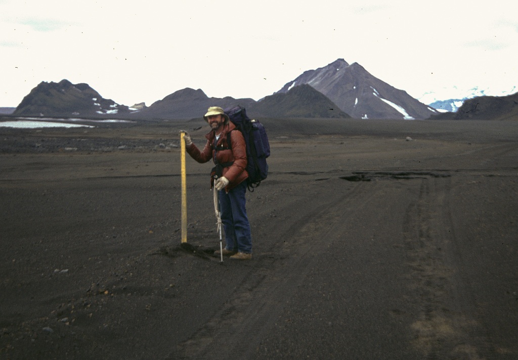
iceland2000 Emstrua bridge
 24June
After a relaxed start, we easily forded the Pronga, not so deep or cold as we had feared, me in my shorts, socks and flops, and Horst in trousers and boots. The dandelions and grass of childless Steinfin s landur (place) soon gave way to more arid slopes. I trudged along, rucksack seeming so heavy, weary legs, calling all the stops as Horst forged along. Coffee/biscuit break, and noodles-lunch by a snow-banked stream. On again, down to a fearsome but bridged river then up and across to two huts at 560m Emstrur by 5pm. One was unlocked and unmanned, with a Kr 1200 overnight non-member fee on an honour system. We were not playing that game - or perhaps we were, as we pitched tent outside and only sat cosily inside to cook and eat and relax. I found an old Emma, praise the lord, and started reading. We ate and talked, and at 11pm I walked up to a ridge to see the low northern sun and glimpse (I thought) Hekla near it on the north-west horizon, before cosy bed in tent.
24June
After a relaxed start, we easily forded the Pronga, not so deep or cold as we had feared, me in my shorts, socks and flops, and Horst in trousers and boots. The dandelions and grass of childless Steinfin s landur (place) soon gave way to more arid slopes. I trudged along, rucksack seeming so heavy, weary legs, calling all the stops as Horst forged along. Coffee/biscuit break, and noodles-lunch by a snow-banked stream. On again, down to a fearsome but bridged river then up and across to two huts at 560m Emstrur by 5pm. One was unlocked and unmanned, with a Kr 1200 overnight non-member fee on an honour system. We were not playing that game - or perhaps we were, as we pitched tent outside and only sat cosily inside to cook and eat and relax. I found an old Emma, praise the lord, and started reading. We ate and talked, and at 11pm I walked up to a ridge to see the low northern sun and glimpse (I thought) Hekla near it on the north-west horizon, before cosy bed in tent.
25-6-2000 (day 9)
 After a good night's sleep and breakfast in the hut we were on our way. Following the initial up it was black desert with mostly horizontal walking, the occasional ups were gentle. The first stream we came to we had to take our shoes off, it wasn't difficult. The next one over the Prætotangi was a bit more of a challenge and required us to put on our river crossing gear, i.e. sandals and trousers rolled up to above the knee. The water was cold, it was @#$%"ing cold, what a pleasure to step out of the stream and to feel the pain go away. I earned on walking to the next crossing point about 500m on. I found a bridge and what was great a sheltering wall behind which the sun was shining and it was nice and warm. Up to that point we had an overcast sky with a cold unpleasant wind blowing biting my ears. The warmness inspired us to wash some essentials in the river and to change underpants. Jim even washed some cloth. It was a long stop, but eventually we had to go past some unused huts which are probably only used during the season, from the 1-July on to end of August.
 Two more wades through rivers and we were at Alftavatn hut. Here we were informed that the last wade was not necessary since there is a new bridge a bit further upstream. Again nobody at the hut, so we did the usual, putting up the tent and using the kitchen for coffee, dinner and breakfast.
25 June
making 7 am tea and porridge in warm cloudless-sunny hostel as Horst snoozes. Vinsamlegast takid allt rusl med ykkur til nazsta skala - OK I'll take all my trash on to the next hut. Vinsamlegast prifid skalann adur en piofario - OK I'll also clean the hut before I leave at 8.45 am
Innri-Emstud, 11.45am
Sat me down by thundering waters
right below a rust-beamed bridge,
twenty feet of splintered cliff
Buff-brown ice-melt tumbling, foaming,
Myrdalsjökull's springtime teardrops
slicing black-dust miles of flood plain
flanked by spiky lava ranges.
Here rode flosi;s hundred horses.
two days out from Svinafell,
blest by priest at Kirkybuyar,
bound for tryst and swelling vengeance,
bent on finishing Skarp-Hedin
and his kin, but not his legend.
Cold the winds, and loud the hoofbeats.
Sharp the rocks - more sharp the axe.
 It was cloudy and cold in the morning as we hiked past Hattafell on long flatflood-plains of black grit and occasional snow patches. At 1 pm we waded quite a wide stream in flops, short socks and underpants, then used a nice bridge over a torrent by a terrifying jeep ford. We washed some clothes and body, had lunch , and H snoozed in the sun. sheltered from the wind by a low cliff. A low heat-haze shimmered above the dark sunny ground with almost no growth - grassy tufts, small flower shoots, a green tinge on slopes, and a few pink thrifts.
On we went past 903 m Storasula, crossing several bridges and wading more fords. me less weary now and going fine. At 6pm we were making coffee in The Alftavatn (lake) hut, with the "camping allowed by lake" tent already pitched for later use to avoid that Kr1200 each.
Laugavegsvolk (hikers)
Trolls moved into a hikers hut.
smelly old goats, hairy unwashed;
helped themselves to some coffee grounds -
ecstasy, honey and bitter heav'n.
Ernieson troll, Alvinson troll.
hiking like cheapskates, awfully droll.
1200 Kronur ls the Gistigjald
(overnight charge. overcharged night).
Trolls too poor or too mean to pay,
nights so short and a twenty-hour day.
Here comes a stranger far over the hill;
scampering, tidying, trolls pack up.
Alvinson heads for the Alftavatn shore;
Ernieson tidies and scribbles some more.
Several more strangers come over the hill,
stopping up-valley, avoiding the bill?
Trolls want to visit but want more to eat.
sitting and reading, wind-free in heat.
On with the kettle, heat up the soup -
Time enough later to go making calls.
A proper Icelandic poem (or is it Rabbie Burns!?), from a poetry booklet in Alftavatn hut:
Litlaflugan
Liekur tifar létt um mada steina
Lmlfola grazr vio skrioufot
Blaskel liggur brotin milli hleina
l bwnum hvilir iturnaxin snot
Efég vazri oroin litilfluga
ég inn um gluggann preytliflugio mitt,
og pa ég ei til annars mcetii duga,
ég eflaust gazti kitlao nefio pitt.
continue
return to home page